
A practical guide on how to prepare for an avalanche while hiking in the mountains—covering planning, avalanche forecasts, gear, on-trail protocols, rescue steps, real lessons, and where Pine Cliff Resort can help.
- 1 - avalanche-basics-and-risk-factors #avalanche-basics-and-risk-factors
- 2 - route-planning-and-avalanche-forecast #route-planning-and-avalanche-forecast
- 3 - gear-checklist-for-hikers #gear-checklist-for-hikers
- 4 - on-trail-protocols-and-human-factors #on-trail-protocols-and-human-factors
- 5 - what-to-do-if-an-avalanche-starts #what-to-do-if-an-avalanche-starts
- 6 - real-cases-and-lessons #real-cases-and-lessons
- 7 - checklist-and-trip-template #checklist-and-trip-template
- 8 - local-resources-pine-cliff-resort #local-resources-pine-cliff-resort
How to Prepare for an Avalanche While Hiking in the Mountains
Snow makes the backcountry magical—and unforgiving. Preparing for an avalanche when you plan to hike in the mountains is not about fear; it is about skill, judgment, and repeatable habits. Think of this as a system you can practice until it feels as automatic as tying your boots.
Avalanche Basics and Risk Factors
How avalanches form: the terrain–snowpack–weather triangle
Avalanches happen when a weak layer in the snowpack collapses and a slab slides on a bed surface, often on slopes between 30–45 degrees. Terrain shapes the hazard (steepness, aspect, gullies), the snowpack stores the hazard (weak layers such as facets or surface hoar), and weather loads the hazard (new snow, wind, temperature swings). If two parts of this triangle look sketchy, act conservatively.
Slope angles and terrain traps
Angle is your first filter. If your intended route crosses sustained slopes near 35 degrees, you are in prime avalanche territory. Below those slopes, avoid terrain traps—features like creek beds, road cuts, cliffs, and tree wells that can deepen burial or amplify trauma. Even a “small” slide can be deadly if it funnels into a trap.
Common avalanche problems you might meet while hiking
Wind slabs form quickly on leeward ridges, storm slabs follow heavy snowfall, and persistent slabs linger for days or weeks on buried weak layers. For hikers on early-season or spring snow, wet loose avalanches are also a concern—especially on sun-baked aspects during warm afternoons.
Route Planning and Avalanche Forecast
Read the daily avalanche forecast like a weather report
Before you leave, study the regional avalanche forecast. Most centers use a five-level danger scale from Low to Extreme and identify specific avalanche problems, their likelihood, and expected size. Note which slope aspects and elevations are most suspect. Write down the forecast in a simple sentence you can repeat to your group on the trail.
Map-first planning that keeps you out of trouble
Trace your route on a topo map or digital planner with slope-angle shading. Pre-mark “no-go” slopes above 30–32 degrees, mark safe detours, and identify safe islands of trees or ridgelines where you can pause. Set turnaround times and weather triggers (for example, 2 cm/hr snowfall rate or strong wind transport along ridges).
Plan B is the real plan
Build an alternate objective on lower-angle terrain. If the snowpack does not match the optimism in your head, you will be glad that Plan B already exists. The best avalanche preparation is choosing terrain that does not need heroics to survive.
Gear Checklist for Hikers
The non-negotiables: transceiver, probe, shovel
If you travel on or below avalanche terrain, each person needs a modern avalanche transceiver (beacon), a 240–300 cm probe, and a sturdy shovel. Practice switching your transceiver from send to search with gloves on. Pack fresh batteries, label your gear, and rehearse a full companion rescue every few weeks in winter.
Hiker-specific add-ons that matter
Traction (microspikes, crampons appropriate for your route), an ice axe when slopes harden, snowshoes or skis for flotation, and hard-shell layers to shed wet snow. Carry extra insulating gloves, goggles for spindrift, and a bothy bag or lightweight bivy for emergency shelter. A small first-aid kit with a SAM splint and tape can turn a crisis into a manageable exit.
Packing strategy that saves minutes when they count
Keep beacon on your body, probe and shovel just under the pack lid, headlamp and emergency layers near the top, and snacks where you can reach them without removing gloves. Minutes are oxygen in a burial; do not bury your rescue tools at the bottom of your pack.
On-Trail Protocols and Human Factors
Group movement that reduces exposure
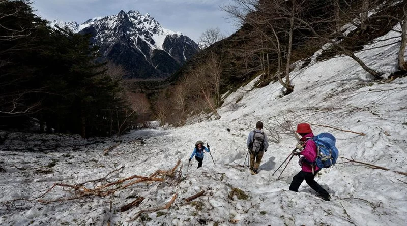
Travel one at a time across suspect slopes while others watch from a safe spot. Maintain voice or radio contact, keep eyes on your partner, and regroup out of runouts. Space out on ascents so a single release does not take everyone.
Micro-observations that refine the plan
Fresh drifts, cracking underfoot, “whumpf” collapses, and rapid warming are red flags. If your gut tightens, treat that feeling as data. Make small test cuts on tiny rollovers that have clean runouts; if a small slab pops, step back into lower-angle terrain.
The brain is part of the snowpack: avoid heuristic traps
Familiarity with a trail, the desire to keep up with a faster group, powder fever, and “summit at all costs” thinking are classic traps. Use deliberate check-ins: “What has changed?” “Where could this go wrong?” “What would make us turn around right now?” A team that speaks up lives longer.
What to Do If an Avalanche Starts
If you are caught
Shout and try to move off the slab toward islands of safety. Ditch ski poles or trekking poles, fight to stay on the surface with a swimming motion, and as the slide slows, thrust a hand upward and create breathing space in front of your mouth. When everything stops, expand your chest to preserve an air pocket and stay calm to conserve oxygen.
If your partner is buried
Take a breath, mark the last-seen point, and scan for clues. Switch all transceivers to search, move fast along the signal line, then perform a fine search and pinpoint with your probe. Shovel downhill of the probe using a conveyor technique; dig wide. Most successful rescues happen in the first 10–15 minutes—speed and teamwork matter more than perfection.
Real Cases and Lessons
Why stories change behavior
Well-documented incidents such as the 1999 avalanche in Galtür, Austria, the 2015 Everest Base Camp slide triggered by an earthquake, and a widely discussed Utah canyon accident remind us that avalanches do not care if you are skiing or simply hiking on a snowed-in trail. Common threads include terrain traps, unexpected weak layers, and groups that missed subtle red flags. When you read a case report, ask: “Which decision would I change?” Then bake that answer into tomorrow’s plan.
Translating lessons into action
In several high-profile accidents, a simple terrain choice—staying on a rib rather than under a wind-loaded bowl—would likely have prevented tragedy. Preparation is not only gear; it is the discipline to prefer boring, beautiful, safe travel over dramatic slopes when conditions are uncertain.
Checklist and Trip Template
The night before
1) Read the avalanche forecast and weather. 2) Choose terrain that fits the forecast and your team’s skills. 3) Charge radios and pack beacon, probe, shovel where you can reach them. 4) Tell a trusted person your plan and return time.
The morning of
1) Perform a beacon group check at the trailhead. 2) Reconfirm hazards, aspects to avoid, and turnaround triggers. 3) Warm up with a small slope-angle test and observe for cracking or wind drift.
On the route
1) Travel one at a time through exposure. 2) Reassess at each decision point. 3) If anything feels off—new wind loading, collapsing layers, rising temperatures—shift to your lower-angle Plan B without debate.
Local Resources—Pine Cliff Resort
Training makes everything above easier. At Pine Cliff Resort you can find curated recommendations for avalanche-ready hiking gear, local shop partners for transceivers, probes and shovels, and seasonal clinics that teach practical rescue skills. If your group needs a skills refresher or guidance on choosing conservative terrain, Pine Cliff Resort can connect you with trusted instructors and services so your next mountain hike is prepared, not just hopeful.
Cranbrook / St. Eugene KOA Journey
7777 Mission Road, Cranbrook, BC V1C 7E5, Canada
Visit Location PagePioneer Trails Commissary Building
Osceola, MO 64776, USA
Visit Location Page