The Best Camping Navigation Tools for Safe and Easy Outdoor Adventures
- Why Navigation Tools Are Essential for Camping
- Top Camping Navigation Tools for Every Adventurer
- How to Choose the Right Navigation Tools for Camping
- Real-Life Camping Navigation Story
- Tips for Effectively Using Camping Navigation Tools
1. Why Navigation Tools Are Essential for Camping
When venturing into the great outdoors, having reliable navigation tools is crucial for ensuring your safety and helping you navigate unfamiliar terrains. Whether you're a seasoned hiker or a first-time camper, having the right navigation tools can make the difference between a successful adventure and an unsafe one. Camping and hiking often take you through remote locations where signs and trails can be unclear. Navigation tools, such as GPS devices and mapping apps, help you stay on track, avoid getting lost, and reach your destination safely.
2. Top Camping Navigation Tools for Every Adventurer
From advanced GPS devices to smartphone apps, there are several tools designed to help campers and hikers navigate the wilderness. Here are some of the best camping navigation tools to consider for your next outdoor adventure:
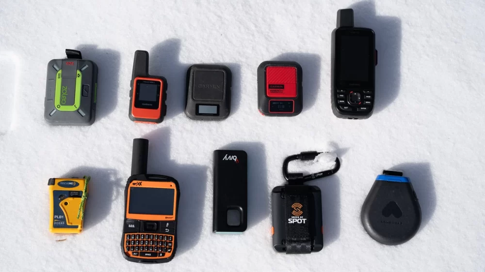
- Garmin inReach Explorer+: A top-rated GPS device for camping and hiking, the Garmin inReach Explorer+ allows you to access detailed topographic maps, track your route, and send messages from remote locations. It's an ideal tool for off-grid camping and wilderness expeditions.
- AllTrails App: Perfect for both novice and experienced campers, the AllTrails app provides detailed trail maps and reviews, making it easier to find and follow the best hiking paths. The app also allows you to track your hikes in real-time, which is useful for navigation and safety.
- Suunto Traverse Alpha: This high-performance GPS watch is designed for outdoor enthusiasts. It offers precise navigation with waypoint marking, a barometric altimeter, and a long-lasting battery for multi-day trips.
- Komoot: Komoot is an excellent app for hikers and campers, offering route planning and navigation tools specifically designed for outdoor activities. It provides detailed offline maps, which can be a lifesaver in remote areas where phone reception is limited.
- National Geographic Trails Illustrated Maps: For those who prefer traditional paper maps, National Geographic’s Trails Illustrated maps offer highly detailed topographic maps that are perfect for backcountry hiking and camping. These maps are rugged, waterproof, and provide essential information about terrain and landmarks.
3. How to Choose the Right Navigation Tools for Camping
Choosing the right navigation tools for your camping trip depends on your specific needs, preferences, and the environment you’ll be exploring. Here are some factors to consider when selecting the best camping navigation tools:
- Device type: Consider whether you prefer using a handheld GPS device, a GPS watch, or a smartphone app. Each option has its advantages: handheld devices tend to offer more detailed maps, while smartphone apps are convenient and lightweight.
- Battery life: When camping in remote areas, battery life is crucial. Make sure to select a navigation tool that offers a long battery life, especially if you're planning on being out in the wilderness for several days.
- Offline capabilities: Since many remote areas lack cellular service, it's essential to choose navigation tools with offline map capabilities. Both GPS devices and apps like Komoot and AllTrails provide offline maps, ensuring that you can navigate even without signal.
- Durability: Whether you're hiking in rainy conditions or trekking through rough terrain, your navigation tool should be durable and weather-resistant. Look for devices that are water-resistant, shockproof, and rugged enough to withstand the elements.
- Ease of use: Consider how easy the tool is to use. Navigation tools with user-friendly interfaces and intuitive controls will ensure that you spend less time figuring out the technology and more time enjoying your outdoor adventure.
4. Real-Life Camping Navigation Story
On a recent camping trip in the remote wilderness of the Canadian Rockies, Emily and her friends found themselves in need of reliable navigation tools. With no cell service and the trail becoming increasingly difficult to follow, they relied on their Garmin inReach Explorer+ to stay on course. As they trekked through dense forests and across rocky paths, they were able to follow the detailed topographic maps on their GPS device. The inReach not only helped them stay on the right path but also allowed them to communicate with their families via satellite messaging, providing an extra layer of security in the wilderness. Thanks to their navigation tools, they completed their multi-day hike safely and with minimal stress.
5. Tips for Effectively Using Camping Navigation Tools
To make the most of your camping navigation tools, here are some practical tips to follow:
- Practice beforehand: Before heading into the wilderness, take time to familiarize yourself with your navigation tool. Practice using your GPS or navigation app in familiar surroundings so you're confident when it's time to use it in the field.
- Update maps regularly: Make sure your maps and devices are up-to-date before heading out. Updated maps will ensure that you have the most accurate and reliable information for your adventure.
- Use waypoints: Mark waypoints on your GPS or map to help track important locations, such as campsites, water sources, and trail junctions. Waypoints make it easier to navigate back to these spots if needed.
- Always have a backup: While digital navigation tools are convenient, it's important to carry a backup map and compass in case your device runs out of battery or malfunctions. Always be prepared for the unexpected.