For Arizonans who live and breathe the outdoor lifestyle, the state offers an incredible spectrum of landscapes, from vast deserts to towering mountains. Among the most cherished regions for those seeking respite and adventure in cooler climes are the majestic White Mountains. Within this stunning natural expanse lies the South Fork Trailhead, a destination that serves as a vital access point to some of Arizona’s most breathtaking wilderness. More than just a starting point for hikes, it represents an opportunity to immerse oneself in a pristine environment, witness the resilience of nature, and enjoy a truly authentic Arizona outdoor experience.
While the name "South Fork Trailhead" might primarily suggest hiking, the surrounding area in Greer, AZ, is renowned for its diverse recreational opportunities, including camping. This article will provide a detailed overview of what makes South Fork Trailhead and its vicinity a prime location for Arizonans looking to explore, hike, and camp amidst the beauty of the Apache-Sitgreaves National Forests. We'll delve into its specific location, the services available, and the unique features that make it a standout destination for local adventurers seeking to connect with Arizona's magnificent high country.
Location and Accessibility
The South Fork Trailhead is located in Greer, AZ 85927, nestled within the expansive Apache-Sitgreaves National Forests. This picturesque location places it in the heart of Arizona's White Mountains, a popular destination for those seeking cooler temperatures and diverse ecosystems compared to the state's lower desert regions. Greer itself is a quaint mountain community known for its serene beauty, fishing streams, and access to vast tracts of national forest land.
Accessibility to the South Fork Trailhead is generally good, via well-maintained roads leading into the Greer area. From major Arizona cities like Phoenix, Flagstaff, or Tucson, the drive involves scenic routes that gradually climb into the higher elevations. The trailhead is situated just south of State Highway 260, offering relatively easy access for vehicles. While the immediate trailhead area is for day use and parking, the broader South Fork Campground (which is associated with the trailhead) provides a base for extended stays. It's important for local users to be aware of seasonal access, as high-elevation areas in Arizona can experience snow and road closures during winter months. However, for much of the spring, summer, and fall, the route to South Fork Trailhead is a pleasant journey, allowing Arizonans to easily reach this mountain sanctuary for hiking and outdoor recreation.
Services Offered
While South Fork Trailhead itself is primarily a starting point for hiking adventures, the broader South Fork Campground area, operated by the U.S. Forest Service within the Apache-Sitgreaves National Forests, offers a range of services designed to support campers and hikers alike. It's important to note that the status of some facilities can be impacted by events like wildfires, so checking current conditions with the Forest Service is always advised.
-
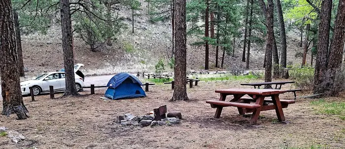
Camping Sites: The South Fork Campground offers designated campsites suitable for both tent camping and RVs. These sites are equipped with picnic tables and campfire rings/grills, providing the essentials for a comfortable outdoor stay. While specific numbers of sites vary, it is known to be a popular campground in the region.
-
Restrooms: Visitors typically have access to vault toilets within the campground area, ensuring basic sanitation facilities are available.
-
Potable Water: Potable water is generally available at the South Fork Campground, a crucial amenity for multi-day trips and for refilling water bottles before hitting the trails.
-
Parking: Dedicated parking areas are available for both day-use hikers at the trailhead and for campers within the campground. This helps manage vehicle traffic and ensures organized access to the trails and campsites.
-
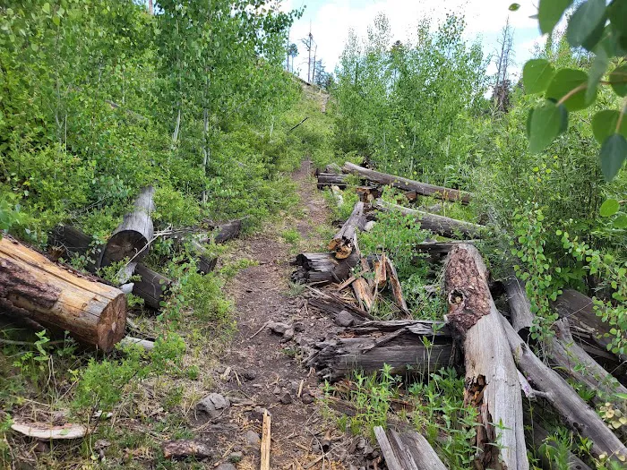
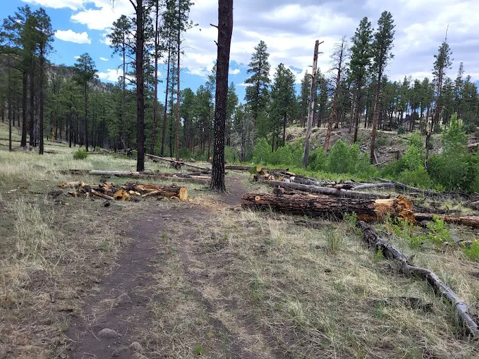
Trail Access: The most significant service is the direct access to the South Fork Trail, which leads into the White Mountain Wilderness. This trail serves as a gateway for various hiking experiences, from shorter, easy walks along the stream to more strenuous, longer treks into the wilderness.
-
Information and Guidance: As part of a national forest, visitors can often find information kiosks or contact the local Ranger District (Springerville Ranger District) for maps, current trail conditions, fire restrictions, and other essential guidance for safe and responsible recreation.
Features / Highlights
South Fork Trailhead and its surrounding area in Greer boast a multitude of features and highlights that draw outdoor enthusiasts from across Arizona. These elements combine to create a memorable and engaging experience for hikers and campers alike.
-
Gateway to White Mountain Wilderness: This trailhead is a key entry point to the expansive White Mountain Wilderness. This means access to pristine, protected natural areas where motorized vehicles are prohibited, ensuring a true wilderness experience for hikers and backpackers.
-
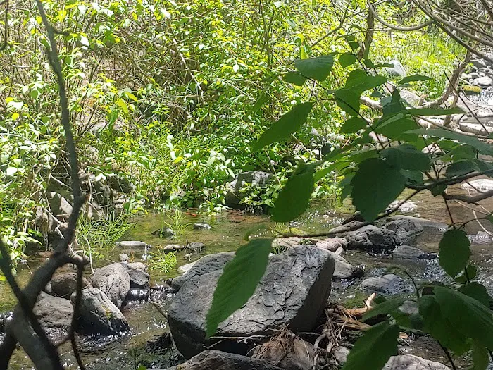
Diverse Hiking Opportunities: The South Fork Trail itself offers varied terrain. Reviews highlight easy sections suitable for beginning hikers, often following a stream, providing picturesque views and opportunities for photography. Further along, the trail can become more strenuous, leading to destinations like Mexican Hay Lake, which is approximately 15 miles out and back. This caters to a wide range of hiking abilities and preferences.
-
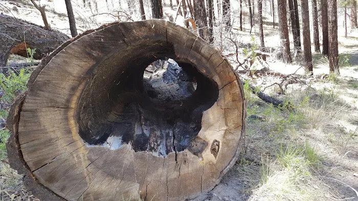
Resilient Natural Landscape: Despite past wildfire damage, the area showcases nature's incredible resilience. The U.S. Forest Service has done commendable work in clearing fallen trees and debris, allowing the trails to remain accessible and highlighting the ongoing recovery of the forest. This offers a unique perspective on ecological processes.
-
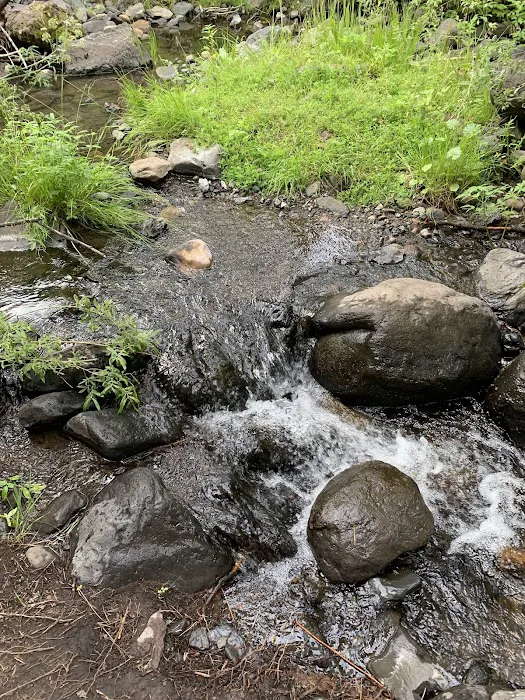
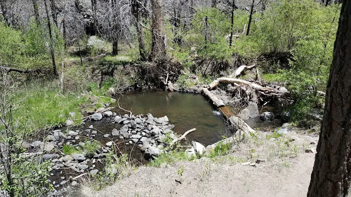
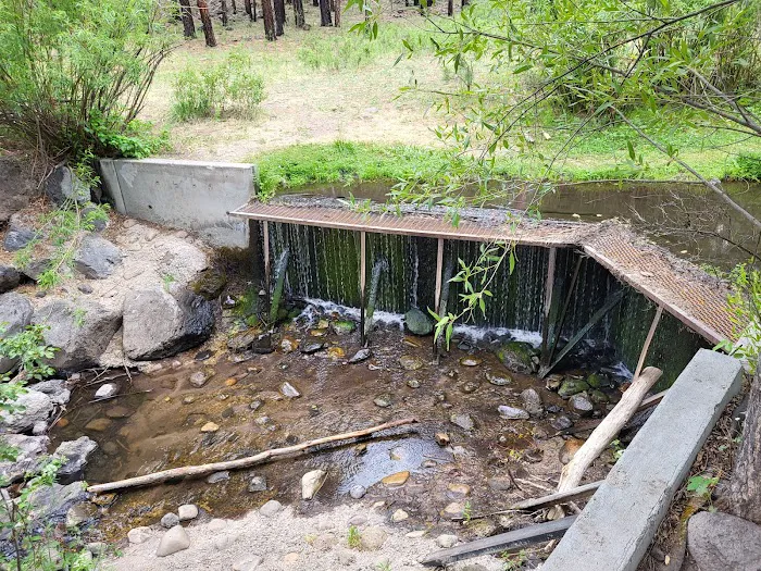
Water Features: The presence of a stream that the trail follows for a significant portion, along with small water crossings, adds a refreshing element to the hike. The destination of Mexican Hay Lake provides a beautiful aquatic focal point for longer treks.
-
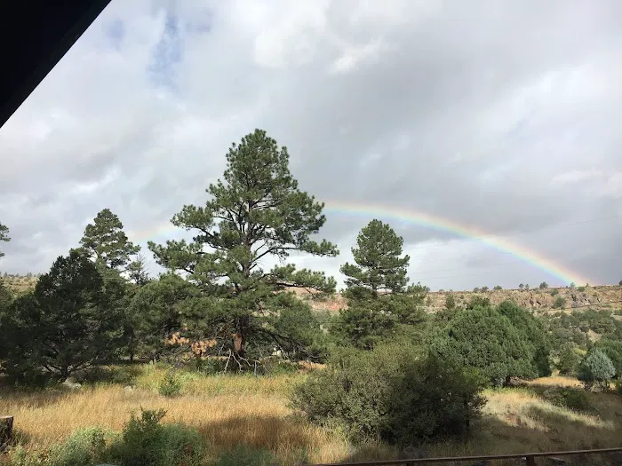
High Elevation Environment: Being in Greer and the White Mountains, the South Fork Trailhead is at a higher elevation, offering cooler temperatures, especially during Arizona's hot summer months. This makes it a popular escape for those looking to beat the heat and enjoy crisp mountain air.
-
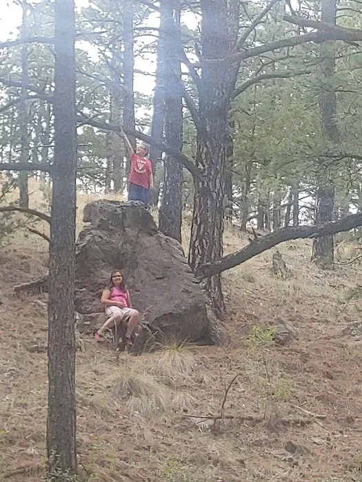
Scenic Beauty and Photography: The beautiful natural scenery, including forested areas, stream views, and mountain vistas, provides ample opportunities for nature photography and simply soaking in the serene environment.
Contact Information
For inquiries regarding the South Fork Trailhead and the associated recreational areas within the Apache-Sitgreaves National Forests in Greer, Arizona, visitors can utilize the following contact information. It is highly recommended to call ahead or check official websites for the most current information on trail conditions, campground availability, fire restrictions, and any potential closures, especially due to weather or natural events like wildfires.
Address: Greer, AZ 85927, USA
Phone: (928) 333-6200
Mobile Phone: +1 928-333-6200
This phone number typically connects to the Springerville Ranger District, which manages the South Fork area. Additional information can often be found on the U.S. Forest Service website for the Apache-Sitgreaves National Forests.
Conclusion: Why this place is suitable for locals
For Arizona residents, the South Fork Trailhead in Greer, and the surrounding Apache-Sitgreaves National Forests, represent an invaluable resource for outdoor recreation and a perfect escape into nature. Its suitability for locals is multifaceted, offering a blend of accessibility, diverse activities, and a refreshing change of scenery that caters directly to the needs and desires of Arizonians.
Firstly, its location in the White Mountains provides a vital high-elevation retreat from Arizona's intense summer heat. While much of the state sizzles, Greer offers cooler temperatures, making it an ideal destination for summer hiking, camping, and simply enjoying crisp mountain air. This regional climate difference makes it a prime local getaway for families and individuals seeking comfortable outdoor adventures year-round.
Secondly, the variety of experiences available, centered around the South Fork Trailhead, caters to a wide range of outdoor enthusiasts. Whether you're a casual hiker looking for an easy, scenic walk along a stream or a seasoned backpacker aiming for a challenging multi-mile trek to Mexican Hay Lake, there's a path for you. This versatility ensures that locals of all skill levels can find an enjoyable and rewarding outdoor activity. The ability to witness nature's resilience after fire events also offers a unique educational aspect, showcasing the dynamic beauty of Arizona's ecosystems.
Furthermore, the opportunity for both day hikes and traditional camping in a well-maintained, Forest Service-managed area means Arizonans have reliable access to quality outdoor infrastructure. The provision of amenities like restrooms, water, and designated campsites, coupled with the peaceful, natural environment, makes it a comfortable yet authentic wilderness experience. It's a place where families can create lasting memories around a campfire, where individuals can find solitude for reflection, and where groups can embark on shared adventures, all within a reasonable drive from their homes. For those who cherish the diverse landscapes and the spirit of the Arizona outdoors, South Fork Trailhead is not just a destination; it's a cherished local escape.